


Unity Voting District, Cassia County, Idaho
About
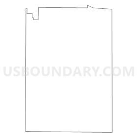
Outline
Summary
| Unique Area Identifier | 563969 |
| Name | Unity Voting District |
| County | Cassia County |
| State | Idaho |
| Area (square miles) | 17.46 |
| Land Area (square miles) | 17.45 |
| Water Area (square miles) | 0.02 |
| % of Land Area | 99.91 |
| % of Water Area | 0.09 |
| Latitude of the Internal Point | 42.48398340 |
| Longtitude of the Internal Point | -113.76117950 |
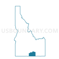
Maps

Graphs
Select a template below for downloading or customizing gragh for Unity Voting District, Cassia County, Idaho


Neighbors
Neighoring Voting District (by Name) Neighboring Voting District on the Map
- Burley 4 Voting District, Cassia County, ID
- Burley 8 Voting District, Cassia County, ID
- Pella Voting District, Cassia County, ID
- Springdale Voting District, Cassia County, ID
- Starrahs Ferry Voting District, Cassia County, ID
- View Voting District, Cassia County, ID
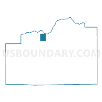
Top 10 Neighboring County Subdivision (by Population) Neighboring County Subdivision on the Map
- Burley CCD, Cassia County, ID (14,177)
- Declo CCD, Cassia County, ID (3,316)
- Albion CCD, Cassia County, ID (3,006)
Top 10 Neighboring Place (by Population) Neighboring Place on the Map
Top 10 Neighboring Unified School District (by Population) Neighboring Unified School District on the Map
Top 10 Neighboring State Legislative District Lower Chamber (by Population) Neighboring State Legislative District Lower Chamber on the Map
Top 10 Neighboring State Legislative District Upper Chamber (by Population) Neighboring State Legislative District Upper Chamber on the Map
Top 10 Neighboring 111th Congressional District (by Population) Neighboring 111th Congressional District on the Map
Top 10 Neighboring Census Tract (by Population) Neighboring Census Tract on the Map
- Census Tract 9505, Cassia County, ID (5,154)
- Census Tract 9503, Cassia County, ID (4,916)
- Census Tract 9502, Cassia County, ID (3,316)
- Census Tract 9501, Cassia County, ID (3,006)